WhaleAlert: the app preventing vessel strikes
WhaleAlert: the app preventing vessel strikes
Heading to the water? Help protect whales
See
Throughout navigation, WhaleAlert displays 'safety zones' and alerts you of whales in your area.
Report
Share your whale sightings, or reports of distressed whales, to create an alert for other users.
Save
Your action alerts mariners to help them avoid deadly collisions with whales.
Vessel strikes are a leading cause of whale mortality
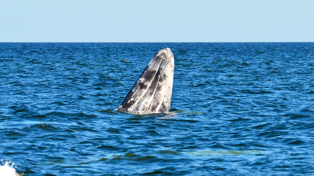
Whales are vulnerable to collisions with all vessel types, sizes, and classes throughout the ocean. As our waterways become increasingly congested, high-traffic areas often intersect key marine mammal habitats. In California, grey whales are the most commonly reported victims of vessel strikes. Along the Atlantic coast, it's the critically endangered North Atlantic right whale. In the Mediterranean, vessel strikes are the leading cause of mortality due to human activity for fin whales and sperm whales. Regardless of location and species, these strikes are often deadly for whales and cause significant damage to vessels.
Luckily, we know the solution—slow vessels down. Public whale sightings submitted via WhaleAlert help establish speed zones, warnings, and other measures to reduce vessel speeds and lower risks to whales.
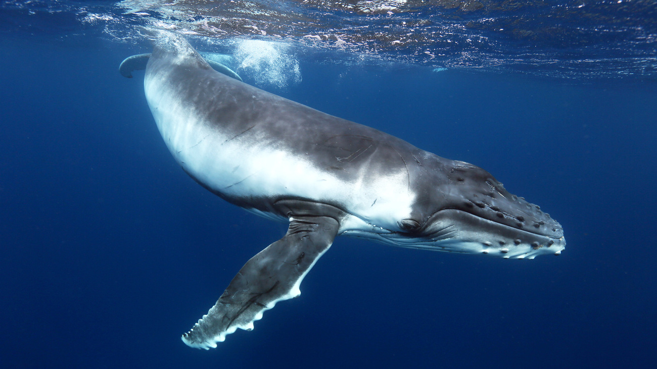
Humpback whales
One of the most popular whales for whale watching, the humpback is vulnerable to vessel collisions on the East and West Coasts of the US, where their migration and feeding habitats overlap with heavy vessel traffic.
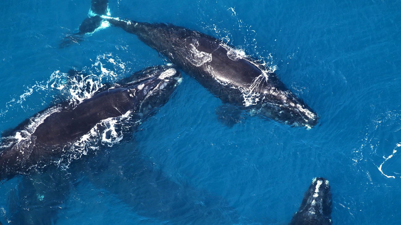
North Atlantic right whales
The North Atlantic right whale is one of the most critically endangered species in the world. With only about 370 individuals remaining, the lethal impact of vessel strikes is an extinction-level threat. IFAW-led research revealed that, between 2003 and 2018, nearly 90% of right whale deaths were caused by vessel strikes and entanglement.
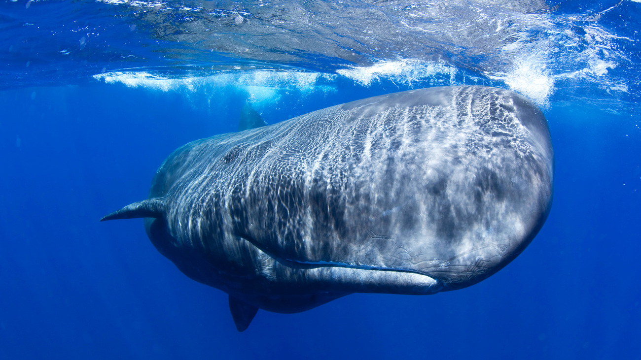
Sperm whales
Sperm whales in the Eastern Mediterranean are at a high risk of vessel strikes due to their critical habitats overlapping with shipping routes. 61% of stranded sperm whales along Greek coasts show signs of collision with a large vessel.
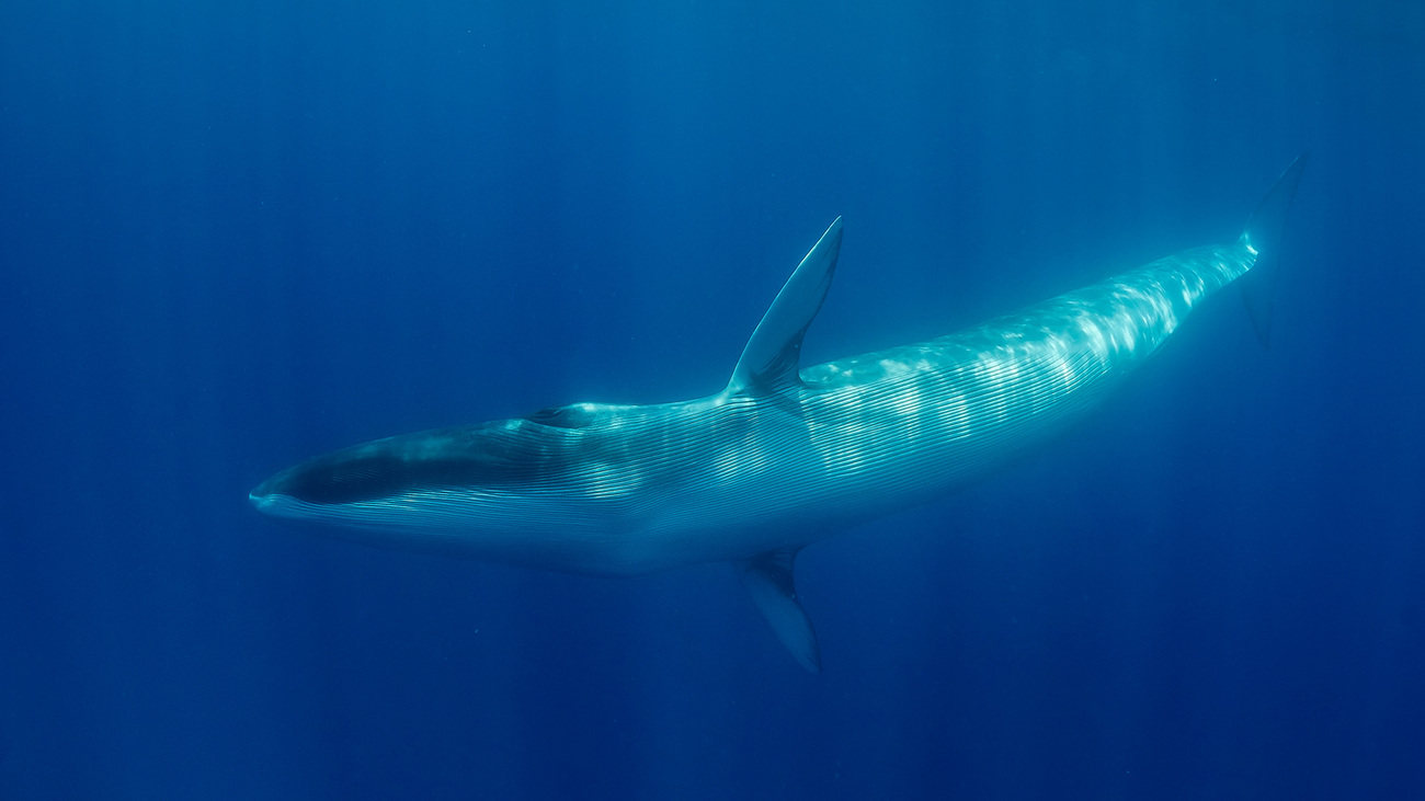
Fin whales
Fin whales are the second largest living mammals on the planet and can reach up to 20 metres in length. The subpopulation living in the Mediterranean has been classified as ‘in danger of extinction’ since 2021. They are highly threatened by vessel strikes since the Mediterranean basin alone contains 30% of global maritime traffic.
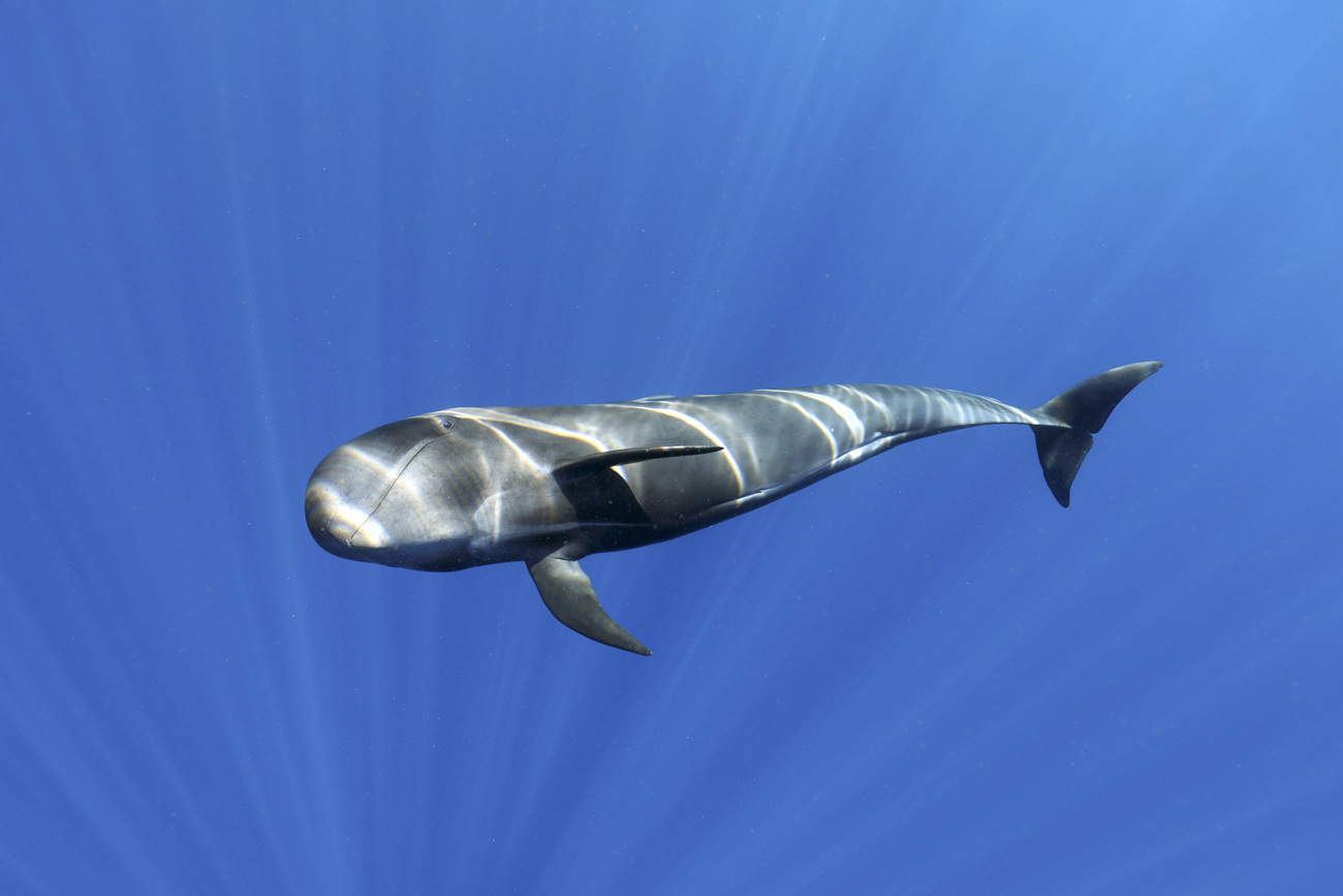
Pilot whales
Pilot whales are easily recognisable because of their globe-shaped heads and black colour. In Europe, they remain on the list of protected species as they are subject to noise disturbances linked to maritime traffic, collisions with vessels, and incidental captures in fishing nets.
WhaleAlert: an app to report whale sightings and prevent strikes
The WhaleAlert app was launched in 2012 as a citizen science tool aimed at reducing the risk of vessel strikes. The app uses whale presence data including verified sightings, acoustic detections from buoys and gliders, and aerial surveys to display a user-friendly map based on nautical charts from country-specific government agencies.
Mariners, scientists, recreational boaters, and beachgoers alike can use their personal devices to easily share whale sightings, which appear simultaneously on the map in gray and turn green once the information has been verified by the WhaleAlert team.
Public whale sightings submitted via WhaleAlert help establish speed zones, warnings, and other measures to reduce vessel speeds and lessen risks to whales and mariners. Contributing to WhaleAlert informs more accurate, evidence-driven administration of management areas to protect both whales and the livelihoods of people on the water.
WhaleAlert also stands out for its capacity to federate multiple data sources to provide the most up-to-date situation awareness possible for users.
So how does it work?
Reporting sightings
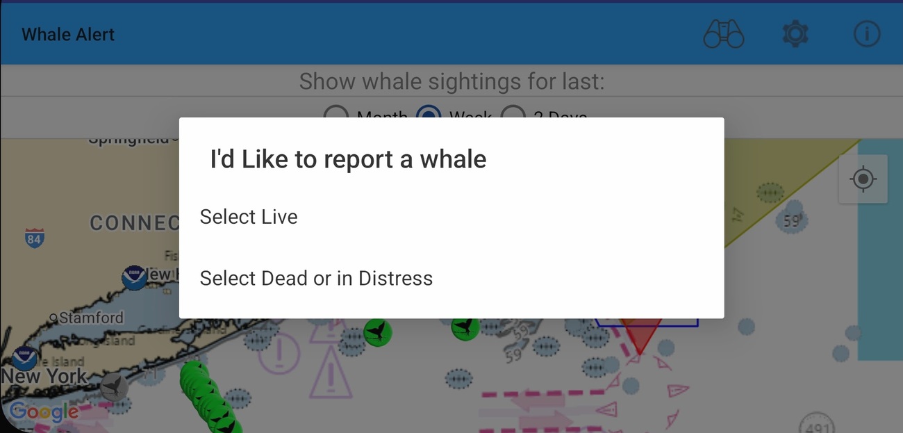
The WhaleAlert app empowers users to report whale sightings via an accessible interface. Users simply select the ‘Report Sighting’ button at the bottom of the screen to share a sighting at their current location and can then upload images, select a species, and leave comments. Each sighting includes species information, number of observations, date of sighting, and source of the sighting.
Critically, WhaleAlert includes the ability to report live, dead, or distressed whales and facilitates phone calls (where required) to direct a report to regional management professionals with the user’s location, enhancing the survivability of whales in distress.
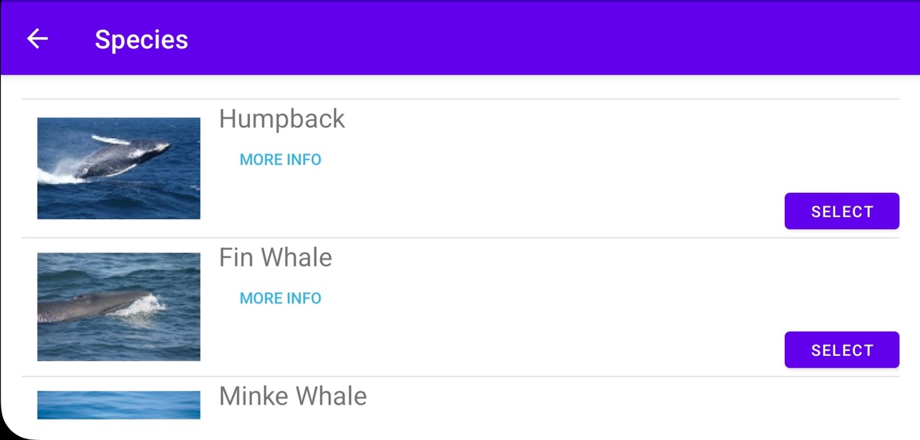
Sightings support
WhaleAlert makes it easy for the public, industry partners, and volunteer networks to log whale sightings in a simple-to-use interface. For those with less experience identifying whales, the app also provides an accessible whale identification guide.
When an observation is made, a gray icon appears on the map. Once the observation has been confirmed by a scientist, the icon turns green.
Science contribution
WhaleAlert data is used by scientists to better understand the areas where whales frequent, study their behaviour, and identify certain individuals using photos. Scientists also use the tool to conduct census campaigns.
If you are interested in accessing WhaleAlert data for your scientific work, please contact: info@whalealert.org.
Mariner alerts
WhaleAlert features several useful tools designed for mariners. Using built-in GPS technology commonly found in smartphones and tablets, the app ‘alerts’ users with visual and auditory notifications when they enter active management zones and when a recent observation close to the ship’s navigation area has been made. By doing so, WhaleAlert makes it easier to navigate the evolving network of overlapping conservation zones and shipping lanes.
In North America, the current roster of zones is supplied by various national and state regulatory agencies including the National Oceanic and Atmospheric Administration (NOAA), Fisheries and Oceans Canada (DFO), Transport Canada, U.S. National Park Service, the California Department of Fish & Wildlife, and the Oregon Division of Fish and Wildlife.
Vessel strike risk information
For mariners, a ship strike indicator will evaluate the risk of collision depending on the size, speed, and location of the vessel, throughout navigation. The aim is to give you an indication of the risk of collision in real time and to show you that by slowing your speed by a few knots, or by being more vigilant in certain sensitive areas, the risk of collision can be reduced.
Alert zones
The application displays information on regulatory zones and enables mariners to find key information to adopt the right behaviour. This information can also be used to prepare your route and avoid sensitive areas. The different types of zones are described below.
FAQ
If you are regularly on the water, contact us about becoming a trusted observer for WhaleAlert.
Promote WhaleAlert in your area using our outreach materials below.
Partners
WhaleAlert’s team

IFAW
IFAW (International Fund for Animal Welfare) is a global non-profit helping animals and people thrive together. We are experts and everyday people, working across seas, oceans, and in more than 40 countries around the world.
We partner with local communities, governments, non-governmental organisations, and businesses. Together, we pioneer new and innovative ways to help all species flourish. From the beginning of WhaleAlert, IFAW has been its principal champion, financial supporter, and lead NGO for outreach and expansion.
Conserve.IO
WhaleAlert's technology stack is developed and maintained by Conserve.IO, a leading provider of mobile technology and data collection for conservation.

Greenov
Created in 2021, Greenov is a company with a mission to innovate and protect marine ecosystems from impacts generated by human activities. Based in Nantes, France, the company works in three main areas: the reduction of underwater noise pollution, the reduction of ship strikes with large whales, and the reduction of biofouling on ships' hulls and underwater infrastructures, using a preventive and non-polluting solution.
Network of partners and contributors
WhaleAlert is part of a global effort to reduce vessel strikes and other human activities that threaten marine mammals. Network partners provide various areas of expertise including technology, research, outreach, and education to increase the effectiveness of whale conservation and protection measures.
Sponsors and donors
History of WhaleAlert
The rules and regulations designed to protect right whales are a result of more than 20 years of effort by scientists, governments, and conservation groups to gather and analyze data on the intersection of whale ‘zones’ and shipping vessel traffic. These risk profiles resulted in management actions to reduce strike risk that (ideally) allow whales and ships to share the same waters, leading to the development of WhaleAlert.
Connect with us >>
info@whalealert.org
‘WhaleAlert’ is trademark protected.
Conserve.IO / International Fund for Animal Welfare / Greenov / U.S. National Marine Sanctuaries